Tornadic Texas Supercell
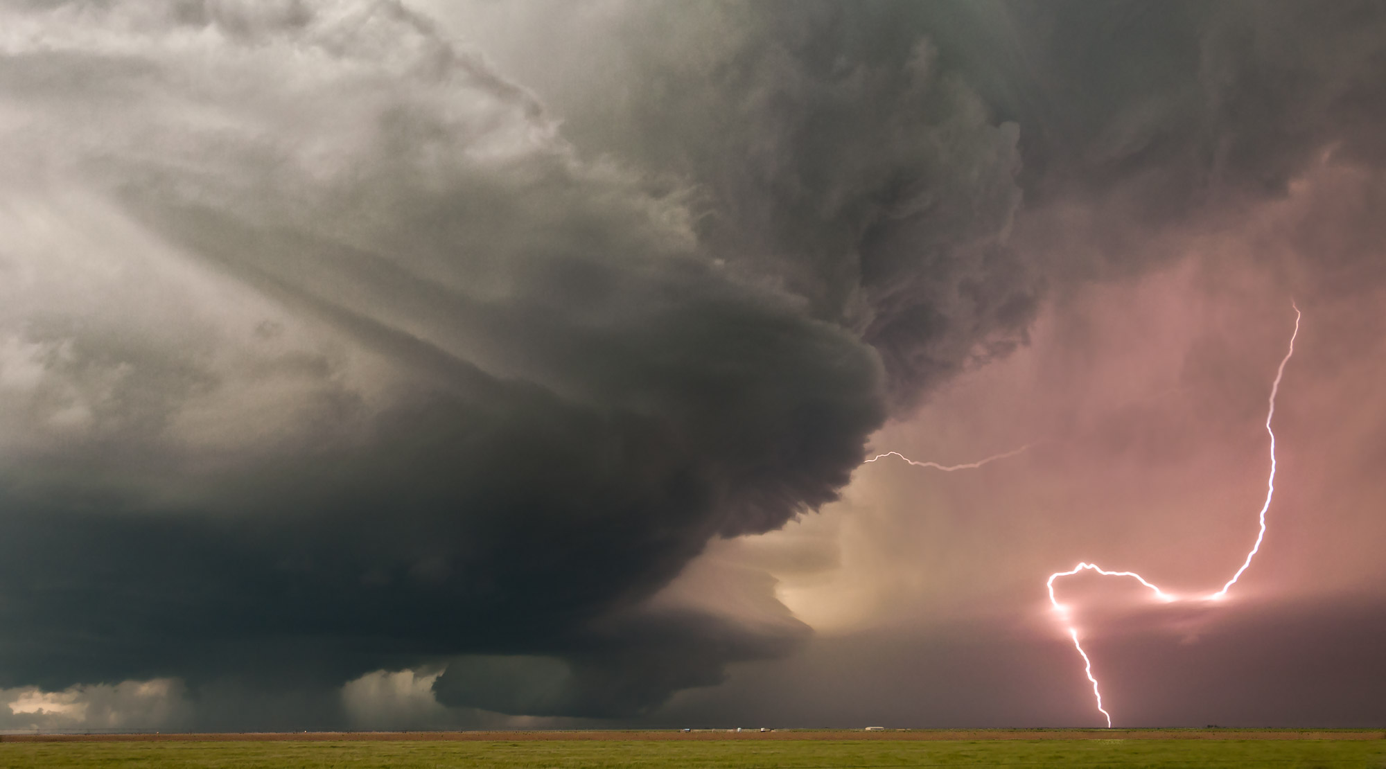
This severe thunderstorm near Dumas, Texas, exhibits classic supercell structure.
The large cloud column to the left of the lightning bolt is a mesocyclone — a rotating updraft. Behind the lightning is a region of intense precipitation — both rain and hail — that marks the storm's main downdraft. The lightning bolt is located in the visual vault [1] — an area between the updraft and downdraft that is relatively free of clouds and precipitation.
A River of Rain and Hail
Most thunderstorms are short-lived. Their updraft creates precipitation which falls straight down, choking off the updraft and killing the storm. However, the split updraft/downdraft structure of a supercell thunderstorm allows it to persist indefinitely, and sometimes grow quite violent. Instead of falling straight down through the updraft, most of the rain and hail is blown by strong upper-level winds and falls some distance away. The strength of the upper-level winds dictate how far the precipitation falls from the updraft, and therefore the width of the visual vault. Imagine, if you can, a river of rain and hail, forming near the top of the updraft, flowing high above the visual vault, and then falling to earth.
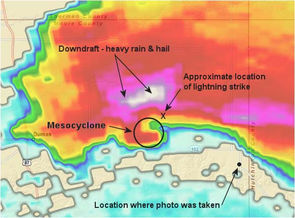
The following radar images show the structure of this storm at about the same time as the lightning strike. I've marked the images with my best guess at the locations of key features. The first image is of the 0.5 degree radar slice, which cuts through this storm at an elevation of about 3,000 feet (roughly the height of the mesocyclone's base). The heavy rain and hail, which is almost certainly reaching the ground, is clearly visible as a region of magenta and white
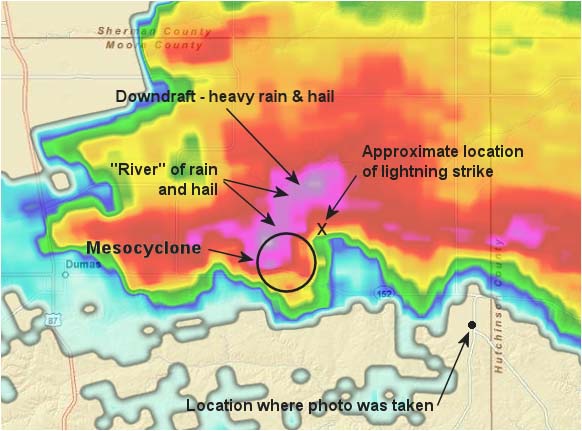
The second radar image is of the 1.8 degree slice, at an elevation of around 8,000 feet. You can see the “river” of suspended rain and hail which originates at the mesocyclone and flows north-northeast to the downdraft, where it falls to the ground.
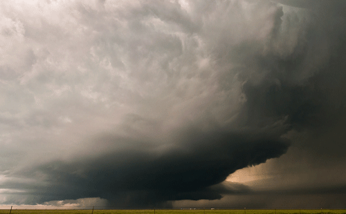
Spinning Like a Top
Mesocyclones are small cousins of the low pressure systems seen on weather maps. They rotate, counter-clockwise in the northern hemisphere and clockwise in the south. This rotation can be seen in the following animated GIF image. This is the same storm as is picture above, photographed 6 minutes later. Even though the animation only has two frames (taken 11 seconds apart), it still gives you an idea of the rotation.
Pearls Along a String
Aesthetically, what I like best about this picture are the pearls of bright light along the lightning bolt. This is where the bolt passes through a thin translucent cloud layer. By luck, the bolt wanders through the clouds three times, giving us a string of three pearls.
Notes
[1] “Visual vault” is an informal term coined by storm chasers to describe the clear area between a supercell's mesocyclone and its primary precipitation core. It should not be confused with “vault”, which is a precise term used to describe a region of low radar reflectivity inside the mesocyclone. The “visual vault” can be seen with the naked eye. The “vault” is always obscured by clouds, and can only be seen on radar.