Cone Tornado near Howes, South Dakota
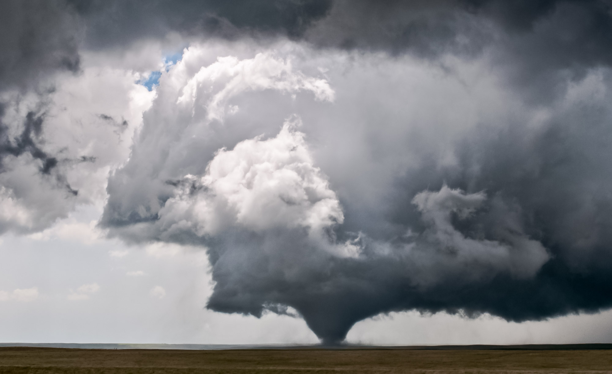
This photo owes its visual impact to a weather phenomenon known as a rear flank downdraft.
Dramatic lighting is what makes this photo work. Bright white clouds, lit by direct sunlight, contrast strongly with the dim underbelly of the storm, making the tornado appear darker and more menacing.
If you look closely, you can see a patch of blue sky. This marks an area where air is descending, warming as it does so. This evaporates any clouds, leaving a hole through which sunlight can pour.
This region of descending air, a common feature of tornadic thunderstorms, is known as a rear flank downdraft. It is found near the back edge of a storm, hence the term “rear flank”. In this photo, we are looking southwest. The storm is traveling north, and the downdraft is located south and southwest of the storm.
A rear flank downdraft often appears just before a tornado, and some have theorized that it plays a role in tornado formation and strengthening.
Another Shot
See South Dakota Cone Tornado and Storm Chasers for another shot of this tornado, taken 3 minutes later from a closer vantage point as it crossed a highway.