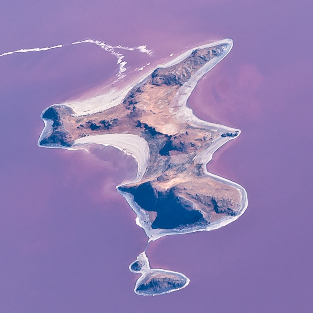
| Caption | The usual reddish-purple color of the water surrounding Gunnison Island is due to the algae Dunaliella salina and bacterium Halobacterium that thrive in the hypersaline brine of Gunnison Bay, the northwest arm of Utah's Great Salt Lake. In the 1950s, a solid-fill railroad causeway was built across the bottom of the bay, isolating it from the rest of the lake and allowing salt levels to rise. Numerous bird species use Gunnison Island as a breeding location. The entire island is part of Gunnison Island State Wildlife Management Area, with access restricted to protect the nesting birds. | |
| Photo Id | w1507-1f08-19930 | |
| Date and Time | June 3, 2006 8:07 PM | |
| Location | Great Salt Lake, Utah latitude 41° 20' 20.8" N longitude 112° 51' 31.0" W | |
| Licensing | A rights-managed license to use this photo is available. View licensing information Send an e-mail requesting a quote | |
| Model Release | No, but a release may not be required for this photo. | |
| Keywords | Gunnison Island, Gunnison Bay, Dunaliella salina, Halobacterium, Gunnison Island, island, State Wildlife Management Area, Great Salt Lake, Utah, UT, United States, aerial, purple, magenta, water | |
| Questions | Send an e-mail asking a question about this photo. |